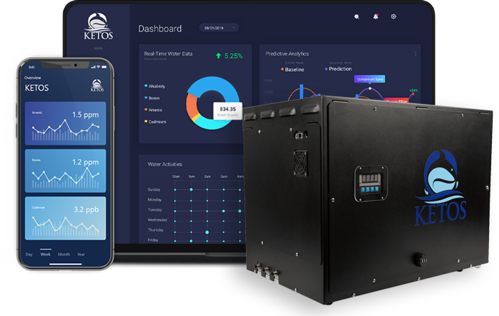


KETOS has a new platform called KETOS PRISM. Currently available on the Databricks Marketplace, KETOS PRISM is an environmental intelligence tool that sources, aggregates, and analyzes publicly available environmental data from various sources, including the EPA, USGS, NOAA, and NASA.
PRISM is designed to help researchers, pre-development construction teams, engineers, public policy offices, and law firms quickly find the latest environmental data based on geographic location. One such area of high interest for many is PFAS insights, and, using KETOS PRISM, KETOS researchers have been able to delve into PFAS to uncover contamination concentrations and implications for public health and policy officials.
This blog is based on a larger report entitled PFAS Contamination in the US. You can download a free summary or buy the full report (alongside the dataset and PFAS Proximity Finder Tool) here.
In our last article, we explored PFAS contamination at the national level under UCMR 5 and dug into some datasets pulled from KETOS’ new environmental data tool, PRISM. Now, we’ll dig deeper by breaking down the data by state to understand where PFAS exposure is most prominent.
Where Forever Chemicals Originate From in the USA
PFAS (Per- and Polyfluoroalkyl Substances) chemicals originate from a variety of industrial and consumer sources in the USA. These chemicals have been used in numerous applications largely due to PFAS’ resistance to heat, water, and oil.
Some of the primary sources of PFAS in America include:
Industrial Processes
PFAS chemicals are used to produce non-stick coatings (like Teflon), waterproof fabrics, and stain-resistant textiles. Companies involved in chemical manufacturing have historically been a significant source of PFAS pollution, releasing these substances into the air, water, and soil. PFAS are also used in semiconductor manufacturing, electronics production, and aerospace industries due to their durable, heat-resistant properties.
Another primary source of PFAS pollution comes from the use of aqueous film-forming foams (AFFF), which are used to combat petroleum-based fires. Airports, military bases, and firefighting training centers have historically used PFAS-containing foams, leading to contamination of nearby water sources. Many military bases and airports are hotspots for PFAS contamination due to the historical use of AFFF in firefighting exercises. This has led to soil and water contamination, particularly around base facilities.
Consumer Products
Products like non-stick pans use PFAS in the US to provide their characteristic slippery surfaces. The use of PFAS for stain or water resistance is common across everyday household items such as clothing, carpets, and upholstery. Certain types of food wrappers and containers also often contain PFAS. Those designed to resist grease (like fast food wrappers) will contain PFAS as well.
How PFAS in the US Proliferates Across Regions
While PFAS in the US are used in manufacturing processes and consumer products, the forever chemicals can enter our water and food supply in a variety of ways, including wastewater treatment, landfills, and agriculture.
Wastewater Treatment Plants
PFAS can end up in wastewater through household or industrial use, eventually contaminating sewage sludge or treated effluent. When sludge is used as fertilizer or water is discharged into local bodies of water, PFAS contamination can spread.
Landfills
Products containing PFAS often get discarded in landfills. Over time, forever chemicals leach into groundwater and surrounding environments, contributing to contamination.
Food and Agriculture
PFAS contamination can enter the food supply through water used for irrigation or by bioaccumulating in livestock and crops, particularly in areas near contaminated industrial sites or military facilities.
These widespread sources contribute to the persistent presence of PFAS in the US environment, affecting both water sources and the broader ecosystem in the USA.
Concerned about contaminants in your water?
Get water testing from KETOS KELP using EPA-certified methodology, results you can trust, backed by real data.
Order a Water Test →PFAS in the US: Detection by State
Since PFAS in the US enters our water supplies in various ways from various sources, PFAS levels can vary from state to state.
Using KETOS PRISM and looking at PFAS data across the country reveals that some states, including Arkansas, Mississippi, North Dakota, and South Dakota, reported no detectable PFAS in their measurements. On the other hand, several states reported alarming detection rates. A demographic analysis based on the sampled data revealed that an estimated 80% of the population of states like Delaware may have been exposed to dangerous PFAS pollution.
Shining Light in PFAS Geographic Data
To answer questions surrounding PFAS, its concentrations, and what geographic and demographic data can reveal, we’ve used our new KETOS PRISM tool to take a deep dive into the number. This comprehensive report goes deep into high-level findings and provides quantitative insights into aspects of PFAS contamination, such as:
- The precise number of locations sampled and the number of locations with PFOA and PFOS levels above the EPA limit
- The locations where the highest levels of each type of regulated PFAS chemical in the US were recorded, and the individual measurements at these locations
- The geographic distribution of PFAS measurements in the US and a breakdown of states with the highest PFAS measurement incidences as well as states with the highest percentage of population potentially exposed to PFAS
- A detailed statistical analysis of the correlation between industry type and PFAS incidence to determine which industries have the highest correlation to PFAS incidence.
In addition, KETOS has also created a free tool called the PFAS Proximity Finder as a Service (PFaaS) tool to assist individuals and businesses in determining their potential level of PFAS risk based on the research included in the report.
We encourage interested readers to try the PFaaS tool to estimate their PFAS Risk and to download our full report. The full dataset used in the analysis is also bundled with the report for no extra charge so that you, too, can dive into the numbers.